We use cookies on this site to help provide the best possible online experience. By using this site you agree to our use of cookies.
Click to view our cookie policy and customize your cookie preferences.
Geospatial image processing, photogrammetry and server technologies. Hexagon is a global leader in the provision of technology for geospatial data analysis and management, including the renowned ERDAS IMAGINE software. The Hexagon Chest Agreement offers four distinct bundles: Desktop Imaging, IMAGINE Add-On Modules (SAR Interferometry and Objective), Enterprise, and M.App Enterprise.
Agreement start: 1 August 2024
Agreement end: 31 July 2027
Subsequent invoice date: 1 May
Institutions may participate in the Agreement at any time during its life, but shall be bound by its Terms and Conditions, including payments, until 31 July 2027.
Site licence for the Desktop Imaging bundle, varied licence types for the other bundles (please see the Product Information tab)
This Agreement is open to Institutions of Higher and Further Education and Research Councils in the United Kingdom, to Universities and Colleges of Further Education in the Republic of Ireland, and to Associated Sites.
Other UK organisations aligned with Chest's charitable objectives of supporting education, research bodies and the public sector may ask to participate in the Agreement. Chest will liaise with the Supplier about any such requests.
The original Agreement for ERDAS IMAGINE was negotiated in 1992/3 after a formal consultation with the Community. The Agreement was extended in 1999 with additional products added and has continued to be renewed at regular intervals. The current agreement has been extended to include a new bundle that offers a licence for IMAGINE SAR Interferometry and IMAGINE Objective at an educational rate.
Owner: Hexagon, a US corporation having its headquarters at 305 Intergraph Way, Madison, AL 35758, USA, acting through its sole appointed UK Supplier, Geospatial Insight Ltd, a company registered in England and Wales (company number 8144558), whose registered office is Coleshill House, 1 Station Road, Coleshill, Birmingham, B46 1HT.
Hexagon – Desktop Imaging Bundle:
Desktop Imaging – this is a site licence for the complete image processing suite, from ingestion and correction through to enhancement, classification, feature extraction and change detection. Recently upgraded to allow native point cloud support and analysis, this tool also provides integration routes with a wide range of desktop GIS, including the Esri product portfolio. The components are:
Hexagon - IMAGINE Add-On Modules Bundle:
This bundle offers one concurrent user licence of IMAGINE SAR Interferometry and IMAGINE Objective. The Desktop Imaging Bundle is a prerequisite to enable these add-on modules.
Hexagon – Enterprise Bundle:
The Enterprise Bundle offers 3 Apollo Professional Workgroup licences. Each Apollo Professional Workgroup includes a Professional 16-core primary licence and a Professional 16-core secondary licence. It is not an unlimited licence model as it is designed to be installed and used as an enterprise solution rather than for mass installation on individual machines.
Hexagon – M.App Enterprise Bundle (annual licence valid for 1,000 hours):
M.App Enterprise is a privately hosted cloud platform for creating geospatial apps across multiple platforms including browser, desktop and mobile. The powerful geoprocessing engine offers hundreds of operators and analytical routines taken from ERDAS IMAGINE and GeoMedia, giving the optimal advanced raster and vector solution. Including specialist functionality such as photogrammetry and radargrammetry as well as AI and machine learning functionality. In addition, the integration of LuciadFusion technology allows connection to any spatial data source through direct connections to commonly used databases.
The key features of M.App Enterprise are:
For complete product descriptions, please visit Hexagon's Safety, Infrastructure & Geospatial division.
Trials are available, please send your request to Chest Help.
Geospatial Insight have produced documentation specifically for Chest sites - this includes installation and licensing guides.
Onsite training is available and delivered by Geospatial Insight. Please send your request to support@geospatial-insight.com and a member of the team will be in touch to discuss your requirements.
Technical support for users in the UK and Ireland is provided by Geospatial Insight. Contact the team via support@geospatial-insight.com.
You can also find information on the Hexagon Support Portal.
Designed for university educators, the Hexagon Geospatial U community contains thousands of pages of curriculum including presentations for lectures and lecture notes, example data, and step-by-step tutorials for students to follow for lab exercises. Registration is through application.
Supplier home page: https://geospatial-insight.com
Geospatial Insight is a Hexagon Partner responsible for software delivery and technical support for academic and research institutions across the UK and Ireland.
System requirements and technical information can be found as part of the ERDAS IMAGINE 2023 Release Guide.
If you require further assistance, please contact Geospatial Insight Support – support@geospatial-insight.com
Downloads are available here. You will be required to enter your credentials in order to download products.
Click on the image below to watch the recording of the webinar held on 12 February 2025.

Click on the image below to watch the recording of the webinar held on 23 July 2024.


Spatial Modeler is one of the most versatile yet user-friendly tools ERDAS IMAGINE has to offer, enabling those without advanced programming skills to build complex geospatial models, analyse data and visualise results.
Click on the image below to watch the recording of the webinar held on 5 July 2023.

Hexagon Geospatial U is an online community for all Hexagon university educators, containing thousands of pages of curriculum including presentations for lectures, lecture notes, example data and step-by-step tutorials for students to follow for lab exercises. The curriculum materials are available to download and use as is or as a template with local datasets.
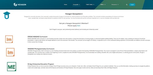
The ERDAS IMAGINE Curriculum is a set of training exercises, broken down into sections, to teach from the basics of viewing imagery, to advanced spatial modelling building. There are 30 chapters, each containing an instructor PowerPoint presentation, a step-by-step tutorial, and sample datasets to use for the exercises in the tutorials. The curriculum can be taught in its entirety or separated out for a more customised training experience.
To access this wealth of teaching material register here.
Byte-sized tutorials in using different features of ERDAS IMAGINE are also regularly added to Geospatial Insight's YouTube Channel.
Licensor: Geospatial Insight Ltd, a company registered in England and Wales (company number 8144558), whose registered office is Coleshill House, 1 Station Road, Coleshill, Birmingham, B46 1HT.
The Chest Order, together with the Licence Terms and Conditions, and any exceptions listed below, create a legally binding contract between your institution, organisation or company and the Licensor. Therefore please read the terms and conditions carefully and only submit a Chest Order if its terms and conditions are acceptable to your institution, organisation or company and you have the authority to make the financial commitment shown.
The different licence types detailed on the Product Information tab are subject to the terms and conditions for the Standard Chest Licence for Software (October 2023).
Copying of the Software is allowed in accordance with the terms and conditions for the Standard Chest Licence for Software.
On receipt of a completed Chest Order sites will be invoiced for the Agreement year in which the licence is signed. For each subsequent year, sites will be invoiced three months in advance of the anniversary date of the Agreement on 1 May to cover the period from 1 August to 31 July.
A licence year runs from 1 August to the following 31 July. There is no monthly pro-rata charging for sites which become licensed partway through a licence year.
Chest is an Enterprise of Jisc. All Purchase orders must be made out to Jisc Services Ltd, 4 Portwall Lane, Bristol, BS1 6NB to cover all charges plus VAT.
All terms contained in a PO are expressly rejected and do not form part of the Licence or vary the Licence terms in any way.
Payments are due within thirty days of the invoice date; recipients of late payments are entitled to interest in accordance with UK statutory provisions.
At the end of a licence period, sites will be required to delete the software from their systems.
It is the intention of Chest and Geospatial Insight to renew this Agreement. If the Agreement is renewed or extended, then new conditions may apply. If the Agreement is not renewed then any extension is a matter between institutions and Geospatial Insight.
The product(s) may be used by any Authorised User of the Licensee for Educational Purposes which includes the administration and management of the licensee’s educational and research operations. These permissions are described in the terms and conditions for the Standard Chest Licence for Software.
| Students | Yes |
| Academic Staff | Yes |
| Non-Academic Staff | Yes |
| Administration and management | Yes |
| Staff home use rights | Yes |
| Student home use rights | Yes |
| Installation on Hosted Server | Yes |
Home/offsite licences for students and staff use will continue to be available as part of the Chest package. Institutions can continue to issue their licences as individual seats for current students and staff use.
To do this licence administrators can log into the licence portal and issue licences (1 seat per machine) when needed as normal. They will get an activation ID which can be sent to the student/staff member to activate on their machine at home (provided they have internet access). Software is only available to download via the licensing portal to registered users. It is recommended that the software is downloaded and made available locally by each licensed institution.
As home-use rights are already included as standard, personal licences are not required under this Agreement.
Please see Geospatial Insight's Privacy Policy.
Institutions are committed until 31 July 2027. Please see the table below which shows the pricing per year in UK Pounds (£s). All prices exclude VAT which shall apply at the appropriate rate.
A licence year runs from 1 August to the following 31 July; institutions joining mid licence year will be charged for the whole licence year. Institutions may choose to pay for the whole term upfront when placing the initial order but there is no discount for doing so.
Payment terms are shown on the Terms and Conditions tab.
Available to purchase until
ArcGIS - fully integrated suite of enterprise GIS software. The ArcGIS system allows GIS applications to be deployed on desktops, servers, mobile devices, on the web and in the cloud. Developer ...
Available to purchase in perpetuity
The agreement covers a project licence for Isle of Man Digital Map Data and the Isle of Man Spatial Data in DXF or Esri compatible Geodatabase formats, and other derived datasets.
Join our mailing list for the latest news, event information and resources