We use cookies on this site to help provide the best possible online experience. By using this site you agree to our use of cookies.
Click to view our cookie policy and customize your cookie preferences.
Online
Find out how you can license ENVI and SARscape from Harris Geospatial Solutions and ArcGIS from Esri UK for your institution through the Chest Agreements.
Combine Advanced Imagery and GIS Analytics to Derive Business Critical Decisions from One Single Platform
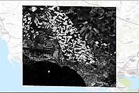
L3Harris Geospatial and Esri have worked together for many years to provide solutions that enable GIS users to seamlessly access and analyze imagery. Across ArcGIS® users, ENVI® and SARscape® are widely recognized as the standards for advanced remote sensing analysis to extract accurate and reliable information from all types of geospatial imagery.
Today, a deep level of integration allows running the advanced image analysis processing tools of ENVI and SARscape directly from prebuilt toolboxes within the familiar ArcGIS interface.
Custom image processing workflows created with the ENVI Modeler can be further added to leverage all types of capabilities to GIS models and applications, such as:
ENVI and SARscape analytics are accessible across all ArcGIS platforms from ad-hoc processing on the desktop to operational implementation in the enterprise, including ArcGIS Pro, ArcGIS Enterprise and ArcGIS Online.
Join this live webinar to learn why with ever-increasing availability of geospatial data, GIS professionals, scientists, and image analysts turn to ENVI and ArcGIS to make business critical decisions with confidence.
This webinar will be co-presented by L3Harris partners Esri España and ESRI India who will demonstrate through real-world examples how analytical capabilities of ENVI and SARscape leverage remotely sensed data in ArcGIS to better understand the complex world around us.
There will be Q&A at the end of the webinar to answer your questions. If you can't attend the live session, register anyway and we'll email you the recording and slides after the webinar.
Join our mailing list for the latest news, event information and resources