We use cookies on this site to help provide the best possible online experience. By using this site you agree to our use of cookies.
Click to view our cookie policy and customize your cookie preferences.
Geospatial image processing, photogrammetry, GIS and server technologies. Hexagon Geospatial is a global leader in the provision of technology for geospatial data analysis and management, including the renowned ERDAS IMAGINE software. Previously listed as the ERDAS Chest Agreement, the Hexagon Geospatial Chest Agreement offers a much wider capability under five distinct bundles: Essentials, Desktop Imaging, Desktop GIS, Enterprise & (new-for-2018) Smart M.Apps.
This Agreement has been renewed for 2021-2024; new and renewal orders should be placed via the new Agreement.
Agreement Start: 1 August 2018
Agreement End: 31 July 2021
Subsequent invoice date: 1 May
Institutions may participate in the Agreement at any time during its life, but shall be bound by its Terms and Conditions, including payments, until 31 July 2021.
Site licence
The original Agreement for ERDAS IMAGINE was negotiated in 1992/3 after a formal consultation with the Community. The Agreement was extended in 1999 with additional products added and has continued to be renewed at regular intervals. The current agreement has been extended to include the whole Hexagon Geospatial portfolio, which includes technologies from ERDAS and Intergraph, to form a single Agreement and the only one spanning GIS, image processing and enterprise solutions for geospatial work.
This Agreement is open to Institutions of Higher and Further Education and Research Councils in the United Kingdom, to Universities and Colleges of Further Education in the Republic of Ireland and to Associated Sites.
Owner: Hexagon Geospatial, a US corporation having its headquarters at 305 Intergraph Way, Madison, AL 35758, USA, acting through its sole appointed UK Supplier, Geospatial Insight Ltd, a company registered in England and Wales (company number 8144558), whose registered office is Coleshill House, 1 Station Road, Coleshill, Birmingham, B46 1HT
Hexagon Geospatial - Essentials – a base version of the world-leading ERDAS IMAGINE and GeoMedia products, this single bundle spans both raster and vector processing. ERDAS Essentials offers the basic tools for image mapping, visualization, enhancement and geo-correction, including image analysis, visualization, vector editing, batch processing and map output. GeoMedia Essentials includes basic feature placement and editing, vector analysis, labelling, geocoding, presentation and map production.
Hexagon Geospatial - Desktop Imaging – previously known as ERDAS, this is a complete image processing suite, from ingestion and correction through to enhancement, classification, feature extraction and change detection. Recently upgraded to allow native point cloud support and analysis, this tool also provides integration routes with a wide range of desktop GIS, including the ESRI product portfolio. The core components are:
Full details of what is included available here.
Hexagon Geospatial - Desktop GIS – at the heart of this bundle is Hexagon Geospatial’s GeoMedia product, a complete Geographic Information System encompassing all the functionality you would expect. From import and vector creation to editing, analysis, transaction management, linear networking parcel management, validation and finally product preparation, creation and printing. Database connectivity is also well supported including direct read of Oracle and SQL vector features. With a site-wide unlimited licence model for a single price, the package offers capability for both teaching and research.
Hexagon Geospatial - Enterprise – this is the only element of the Hexagon Geospatial offering that is NOT an unlimited licence model, as it is designed to be installed and used as an enterprise solution rather than mass installation on individual machines. Providing 5 licences of almost the entire Hexagon Geospatial Enterprise capability, this offering delivers:
Smart M.Apps (new for 2018) - Hexagon Geospatial invites students, professors, and research scientists to build the M.App of the future. Hexagon Smart M.Apps are not your ordinary static maps – they are analytical services portrayed over a map.
M.App Portfolio is a cloud-based geospatial platform that can be used to design, build and host Hexagon Smart M.Apps and core geospatial web services for building geospatial cloud applications. The Smart M.Apps for EDU program includes everything you need to build your own Smart M.App.
Smart M.Apps for EDU program also includes Hexagon Geospatial product SDKs and HGDN specific parts of the Hexagon Geospatial Community. Educators, researchers, and students can access Hexagon Geospatial's development toolkits to modify the commercial version of selected software products or develop entirely new applications to extend the capabilities of the software to meet specific project needs. See Smart M.Apps for EDU Education Program.
For complete product descriptions, please visit https://www.hexagongeospatial.com/
Discover Hexagon Geospatial U
Hexagon Geospatial U is an online community for all Hexagon Geospatial University educators, containing thousands of pages of curriculum including presentations for lectures, lecture notes, example data and step-by-step tutorials for students to follow for lab exercises. The curriculum materials are available to download and use as is or as a template with local datasets.
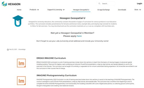
The ERDAS IMAGINE Curriculum is a set of training exercises, broken down into sections, to teach from the basics of viewing imagery, to advanced spatial modelling building. There are 30 chapters, each containing an instructor PowerPoint presentation, a step by step tutorial, and sample datasets to use for the exercises in the tutorials. The curriculum can be taught in its entirety or separated out for a more customised training experience.
To access this wealth of teaching material register here.
Are available, please send your request to Chest Help
Onsight training is available and delivered by Geospatial Insight. Please send your request to support@geospatial-insight.com and a member of the team will be in touch shortly to discuss your requirements.
Please contact support@geospatial-insight.com
Learn more about our products, find answers, get the latest updates, and connect with other product users at the Hexagon Knowledge and Support site. Registration is free and open to everyone.
Users with a Support login can use the same credentials to access the Community portal.
A summary of Hexagon’s Support Guidelines, together with a large range of free resources can be found here - About the Community
System Requirements and Technical Information can be found as part of the ERDAS Imagine 2018 release guide
If you require further assistance, please contact Geospatial Insight Support - support@geospatial-insights.com
Download is available here. You will be required to enter your credentials in order to download the product.
The Chest Order, together with the Licence Terms and Conditions, and any exceptions listed below, create a legally binding contract between your institution, organisation or company and the Licensor. Therefore please read the terms and conditions carefully and only submit a Chest Order if its terms and conditions are acceptable to your institution, organisation or company and you have the authority to make the financial commitment shown.
This Site licence is subject to the terms and conditions for the Standard Chest Licence for Software.
Copying of the Software is allowed in accordance with the terms and conditions for the Standard Chest Licence for Software.
On receipt a completed Chest Order sites will be invoiced for the Agreement year in which the licence is signed.
A licence year runs from 1 August to the following 31 July.
For each subsequent year, sites will be invoiced three months in advance of the anniversary date of the Agreement on 1 May to cover the period from 1 August to 31 July.
Chest is an Enterprise of Jisc. All Purchase orders must be made out to Jisc, 4 Portwall Lane, Bristol, BS1 6NB to cover all charges plus VAT.
All terms contained in a PO are expressly rejected and do not form part of the Licence or vary the Licence terms in any way.
Payments are due within thirty days of invoice date; recipients of late payments are entitled to interest in accordance with UK statutory provisions.
At the end of a licence period, sites will be required to delete the software from their systems.
It is the intention of Eduserv and Hexagon Geospatial to renew this Agreement.
If the Agreement is renewed or extended, then new conditions may apply.
If the Agreement is not renewed then any extension is a matter between institutions and Hexagon Geospatial.
The product(s) may be used by any Authorised User of the Licensee for Educational Purposes which includes the administration and management of the licensee’s educational and research operations. These permissions are described in the terms and conditions for the Standard Software Licence 2011.
| Students | Yes |
| Academic Staff | Yes |
| Non-Academic Staff | Yes |
| Administration and management | Yes |
| Staff home use rights | Yes |
| Student home use rights | Yes |
| Installation on Hosted Server | Yes |
Home/offsite licences for student and staff use will continue to be available as part of the CHEST package. Institutions can continue issue their licences as individual seats for current students and staff use.
To do this licence managers can log into the licence portal and issue licences (1 seat per machine) when needed as normal. They will get a activation ID which can be sent to the student/staff member to activate on their machine at home (provided they have internet access). All software downloads are available with free access online too, so no need to provide this internally. Users just need to abide by the T&Cs.
As home-use rights are already included as standard, personal licences are not required under this Agreement.
The Licensor, UK Supplier and Licensee agree the following:
Currency: All prices are in GBP and exclude VAT
Sites may pay for the whole three year term at time of initial order but there is no discount for doing so.
A licence year runs from 1 August to the following 31 July.
For each subsequent year, sites will be invoiced three months in advance of the anniversary date of the Agreement on 1 May to cover the period from 1 August to 31 July.
Payment terms are shown on the Terms and Conditions tab.
* Sorry, this agreement has expired *
This agreement expired on the 31/07/2023
ArcGIS - fully integrated suite of enterprise GIS software. The ArcGIS platform allows GIS applications to be deployed on desktops, servers, mobile devices, on the web and in the cloud. Developer ...
Available to purchase in perpetuity
The agreement covers a project licence for Isle of Man Digital Map Data and the Isle of Man Spatial Data in DXF or Esri compatible Geodatabase formats, and other derived datasets.
Join our mailing list for the latest news, event information and resources